
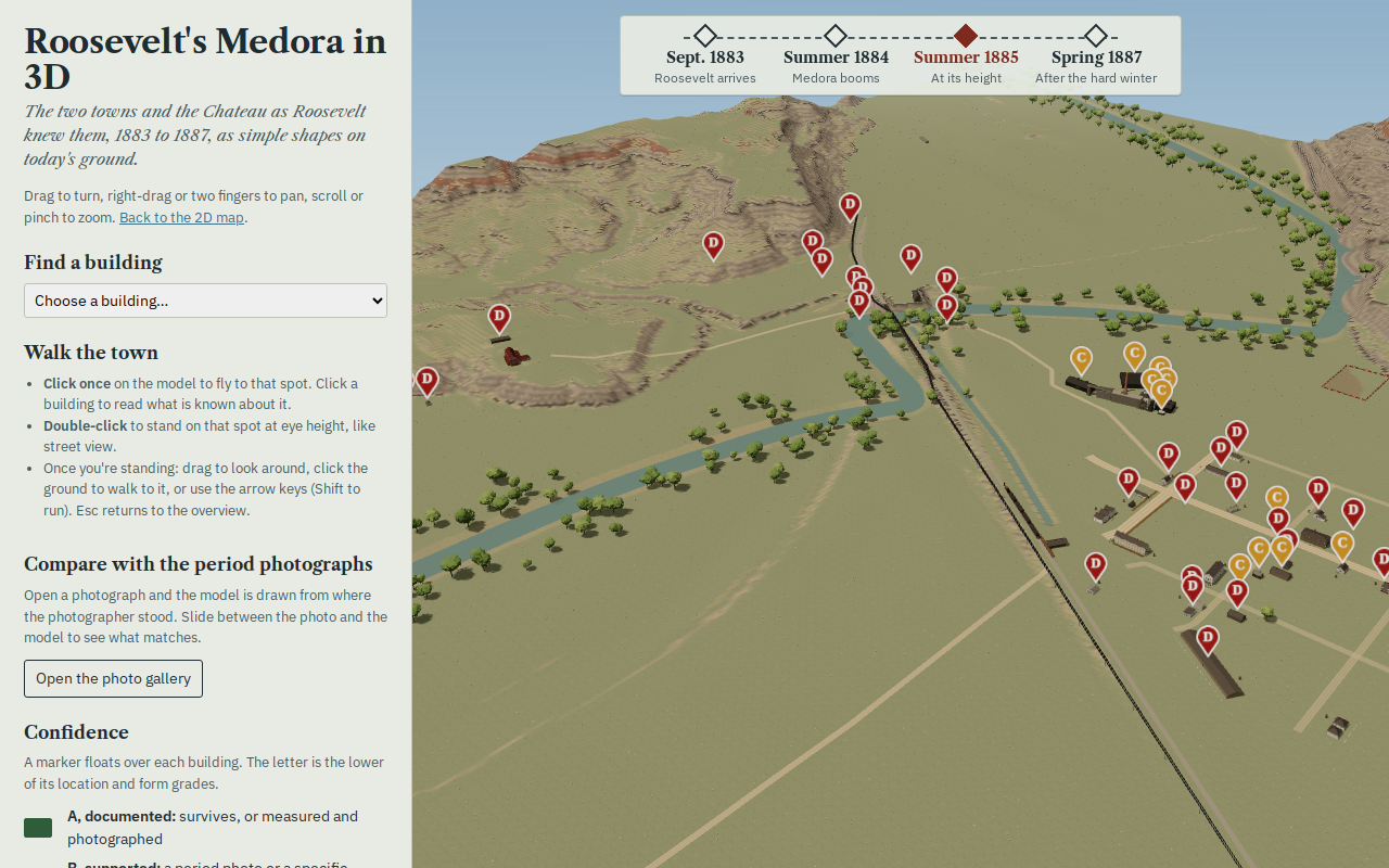
Try it right here
This loads the live project from its own domain, exactly as a visitor would see it.
An internal experiment, published as-is. Much of the town is inferred rather than documented — read the confidence grades before citing anything.
What it does
Little Missouri stood on the west bank of the river. Medora, built by the Marquis de Morès, stood on the east. Between Roosevelt's arrival in September 1883 and the killing winter of 1886–87, both changed almost beyond recognition — and then largely vanished. This rebuilds them: lidar terrain, buildings at measured or estimated heights, across four dates.
The 3D view is the one to open first. It will put you where a photographer stood: the project solves the camera position for surviving period photographs and overlays the original plate on the model, so you can judge for yourself how closely the reconstruction matches the evidence. A companion 2D map covers the same ground with the 1883 plat fitted to today's survey and the river in its original channel.
It is marked beta on purpose. The README calls it an internal experiment, and a good deal of the town is inferred rather than documented — which the project is unusually honest about, and which is the reason to look at it.
What it can do
- Lidar terrain with buildings at measured or estimated heights, across four dates
- Views from solved period-photo cameras, with the original photograph overlaid on the model
- Separate A–D confidence grades for every building's location and its form
- A gazetteer of every known structure with dates, evidence, sources and photographs
- 446 building mentions from the Bad Lands Cow Boy, 1884–86, OCR-checked
- The 1883 plat fitted to today's map, with the river's original channel
Make it your own
Start by forking the repository into your own organization. Everything below assumes you are working in your fork, not this one.
- Fork the repo. The two published views are
map3d/andmap/; everything else builds them. - Replace the historic record in
tools/build_features.py— it is the single spec for every feature, and it writes both the gazetteer and the map data. Do not hand-editdata/buildings.csv. - Grade your own evidence. Each structure carries separate confidence grades for location and for form, A (documented) through D (conjectural). The grades are the honest part; keep them.
- Swap the reference layers in
data/reference/for your own lots, survey sections and plat, and refit the control points. - Run
pip install shapely numpy, thenpython3 tools/build_features.pyandpython3 tools/build_3d.py. - Check image rights before publishing. The 3D photo gallery serves reduced period photographs under educational, non-commercial use; confirm terms with each archive for anything else.
Stuck on a step? Open an issue on the repository. Questions from people adapting these for their own institution are the most useful feedback we get.